Browse all webshop titles

Or search for something specific
Whitbread, [Josiah].
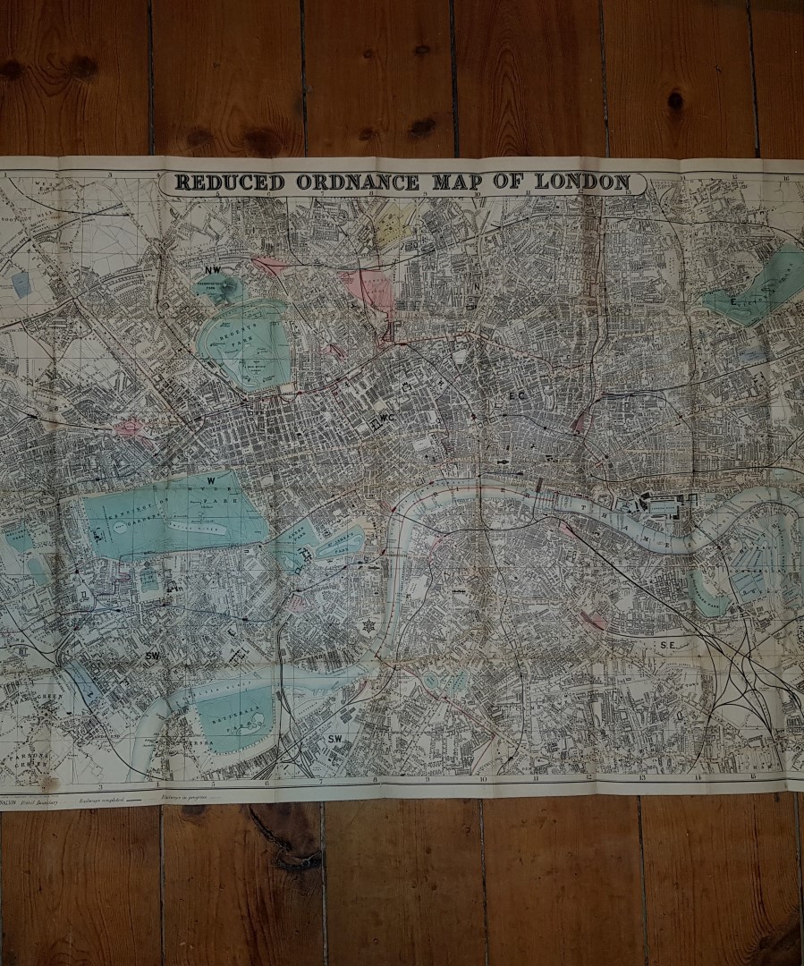
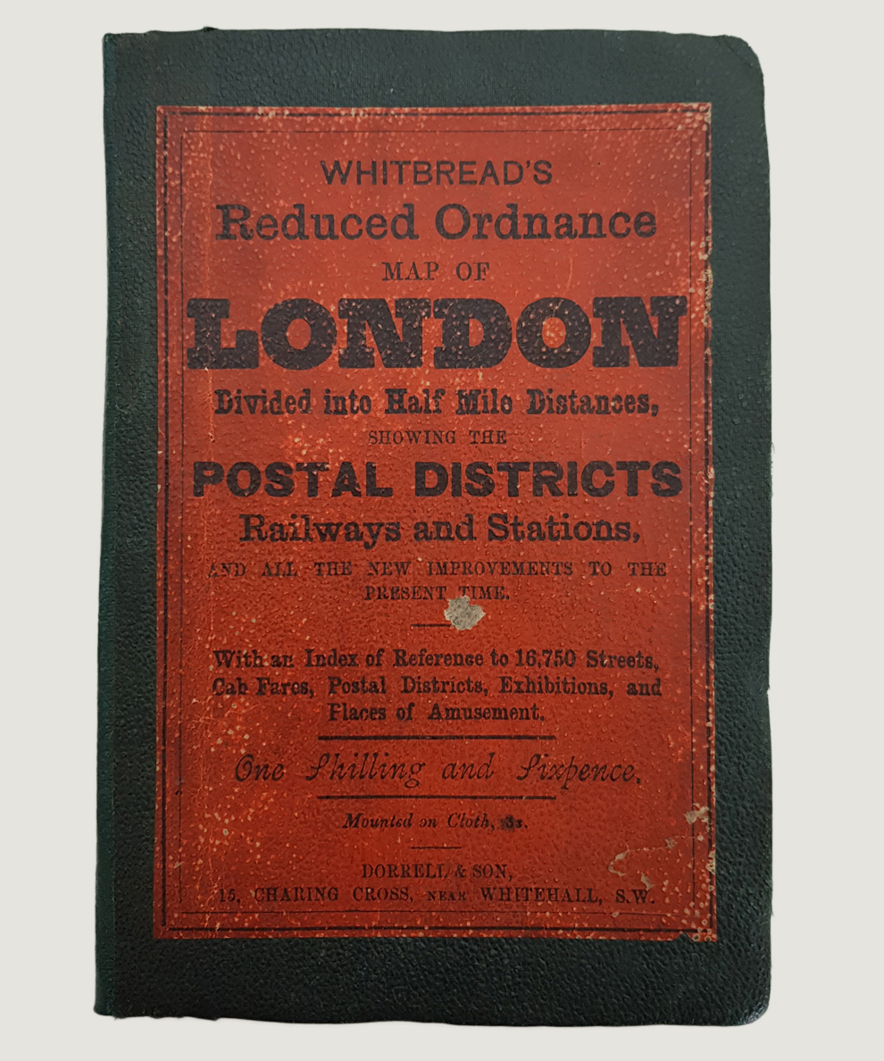
Whitbread's Reduced Ordnance Map of London Divided into Half Mile Distances showing the Postal Districts Railways and Stations and All the New Improvements to the Present Time.
Publisher: Dorrell & Son, London;
Date of Publication: 1878
Stock Code: 9080
Octavo, pp. [2], 37, [1]. Part hand-coloured map mounted on fine linen, approximately 82 cm x 58 cm, folded into limp green pebbled cloth covers. Sympathetically re-cased with printed orange title plate to upper board. Boards a little creased with bruised corners; cover plate slightly scuffed. Tidy ownership inscription to front paste-down. Light foxing, mainly to title page and endpapers; minor loss top edge of final two leaves mainly affecting margin only. Minor wear to map at folds, without loss, and a little foxing mainly to reverse. A very Good copy.
Index references 16750 streets, cab fares, Postal Districts, Exhibitions, and Places of Amusement. Scale approximately 3 3/4 inches to a mile, extending from Kentish Town in the north to Camberwell in the south and from Notting Hill in the west to Limehouse in the east. Scarce.
£225.00


Whitbread's Reduced Ordnance Map of London Divided into Half Mile Distances showing the Postal Districts Railways and Stations and All the New Improvements to the Present Time.
Date of Publication: 1878
Stock Code: 9080
Free postage to any UK address, and
free postage on overseas orders over £150.
Overseas orders below £150 –
Europe £6 / USA £14 / Rest Of World £9
Find out more about international shipping including heavy items & customs & taxes.
All items are guaranteed to be as described & are fully insured in transit. See our returns policy & find out about the bookselling terms we use.