Browse all webshop titles

Or search for something specific
Walis, J.
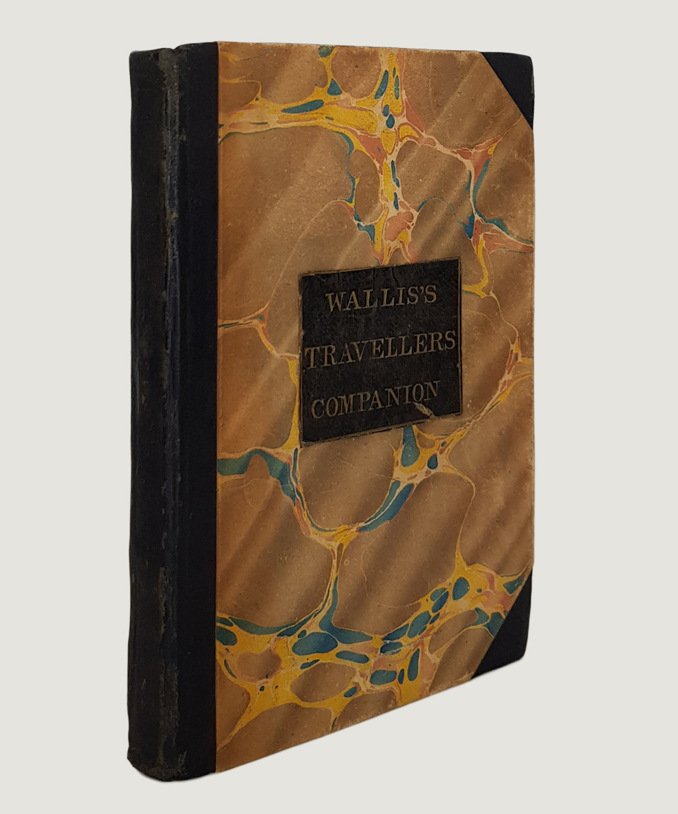
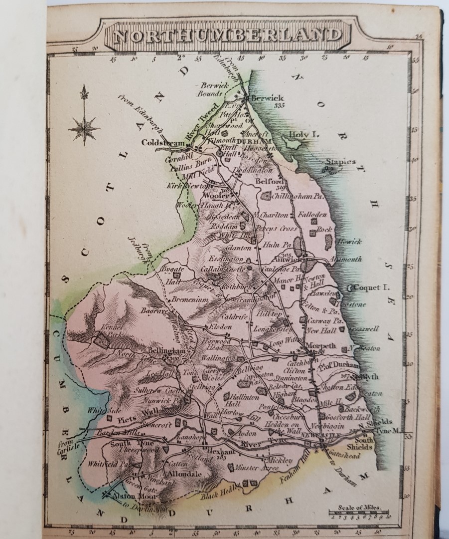
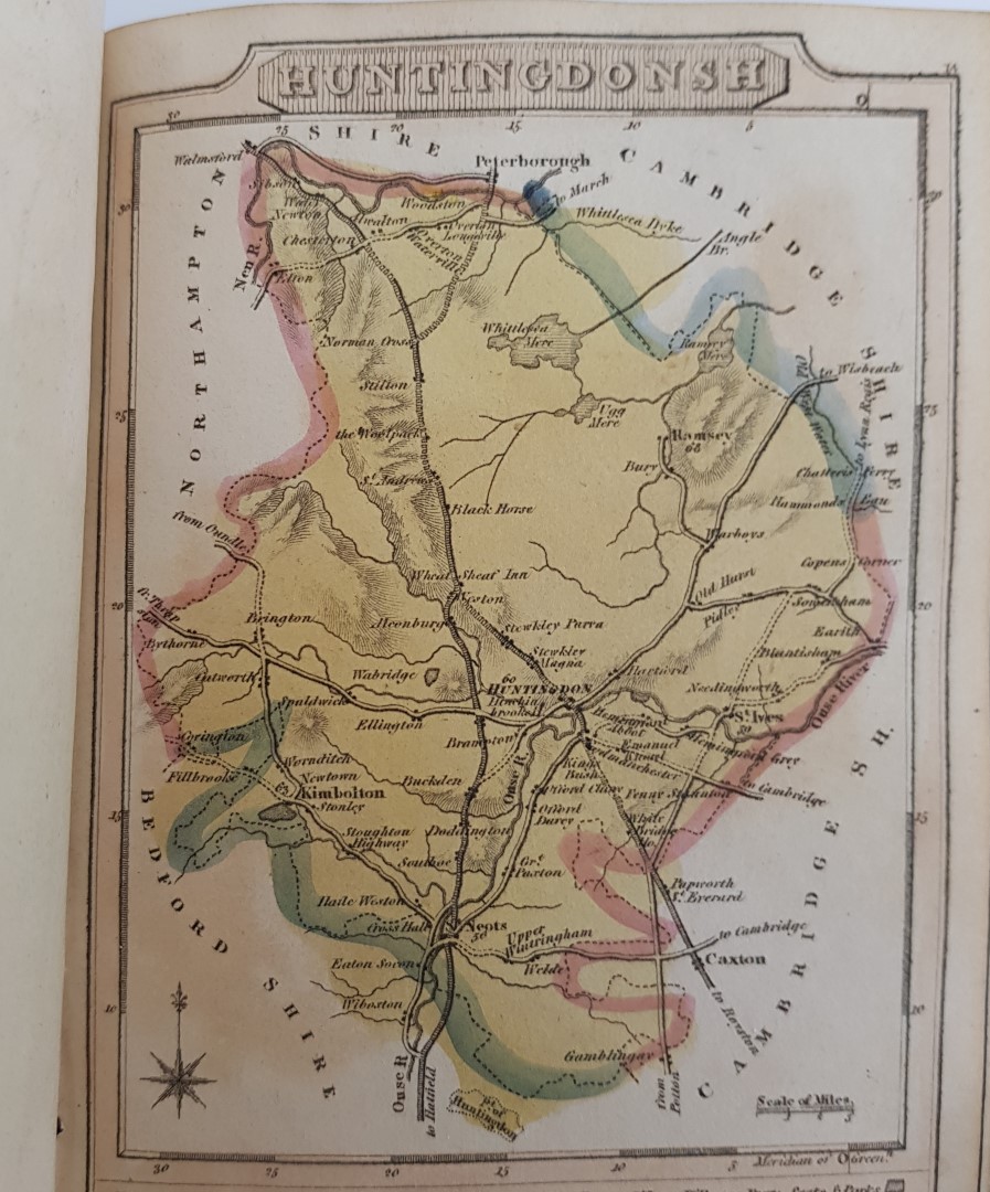
Wallis's New Pocket Edition of the English Counties or Travellers Companion in which are carefully laid Down all the Direct & Cross Roads, Cities, Townes, Villages, Parks, Seats, and Rivers with a General Map of England & Wales.
Publisher: J. Wallis, London;
Date of Publication: 1810
Stock Code: 10050
12 mo (approx 14.5 x 10 cm), pp. [4] comprising title-page and contents, followed by 43 hand-coloured maps as called for, of which one double-page (Yorkshire) plus the additional Isle of Wight map (not included in plate listing) making a total of 44. Maps printed recto only. Re-backed retaining the original marbled boards and black title label gilt to upper board. Calf lightly scuffed. A little light foxing & offsetting, otherwise clean & bright. A Very Good copy.
Pocket-size volume of county maps, with details such as turnpike roads marked with their destinations, and significant settlements and topographical features.
£375.00


Wallis's New Pocket Edition of the English Counties or Travellers Companion in which are carefully laid Down all the Direct & Cross Roads, Cities, Townes, Villages, Parks, Seats, and Rivers with a General Map of England & Wales.
Date of Publication: 1810
Stock Code: 10050
Free postage to any UK address, and
free postage on overseas orders over £150.
Overseas orders below £150, £14.95 worldwide.
Find out more about international shipping including heavy items & customs & taxes.
All items are guaranteed to be as described & are fully insured in transit. See our returns policy & find out about the bookselling terms we use.