Browse all webshop titles

Or search for something specific
Stanford, Edward.
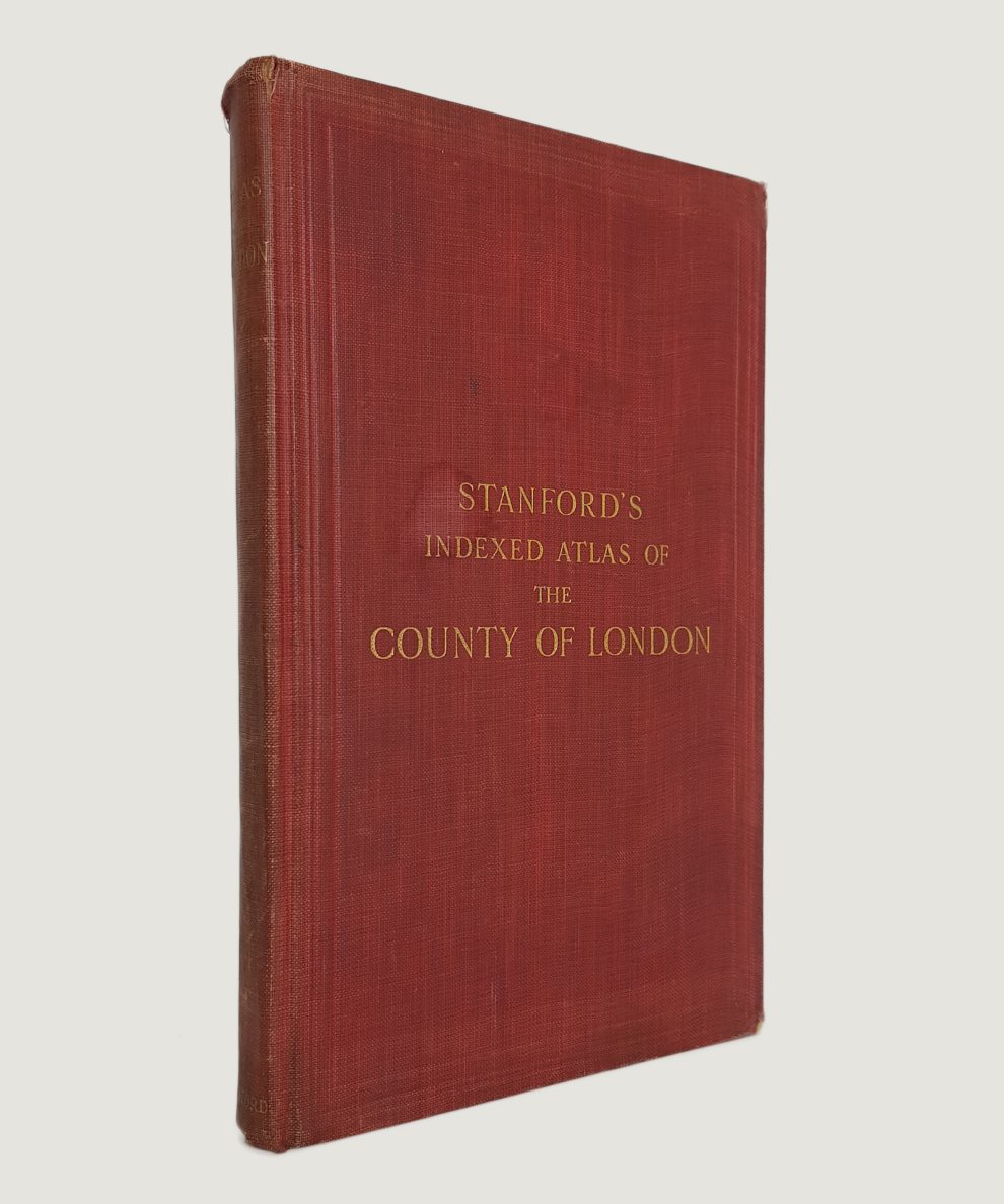
Stanford's Indexed Atlas of the County of London with Parts of the Adjacent Boroughs and Urban Districts.
Publisher: Edward Stanford Ltd., London;
Date of Publication: 1920
Stock Code: 8289
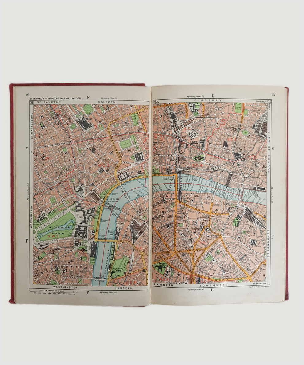
SECOND EDITION. Royal octavo, pp. 6, [2], 86 colour maps including index maps, pp. 159 index. Scale of 4 inches to one mile. Publishers’ red cloth with gilt titles to spine and upper board and triple border in blind to boards. Spine slightly sunned; minor wear at spine tips and corners. Ownership inscription to ffep; note referring to auction in 1920 to rfep in pencil, otherwise contents clean. A Very Good copy.
Second edition of this handy, highly detailed reference (first published in 1911). Postal Districts are bounded in red, Parks and Open Spaces in green, Rivers, Lakes and Canals in blue and Tramway Routes in brown. With Preface by Sir Laurence Gomme.
£250.00


Stanford's Indexed Atlas of the County of London with Parts of the Adjacent Boroughs and Urban Districts.
Date of Publication: 1920
Stock Code: 8289
Free postage to any UK address, and
free postage on overseas orders over £150.
Overseas orders below £150, £14.95 worldwide.
Find out more about international shipping including heavy items & customs & taxes.
All items are guaranteed to be as described & are fully insured in transit. See our returns policy & find out about the bookselling terms we use.