Browse all webshop titles

Or search for something specific
Barber, Peter
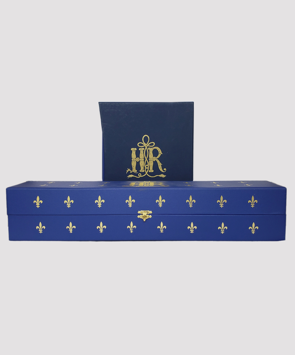
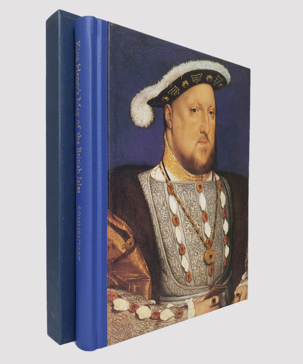
King Henry's Map of the British Isles [boxed map with accompanying slipcased commentary volume].
Publisher: Folio Society, London;
Date of Publication: 2009
Stock Code: 11470
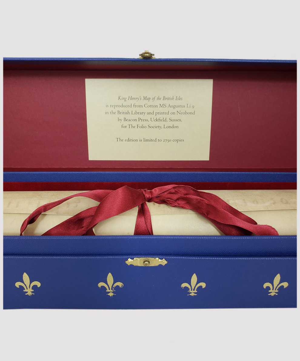
FIRST EDITION limited to 2750 copies. Facsimile map approximately 63 cm x 44.5 cm, printed on thick Neobond paper to resemble vellum, rolled and secured with satin ribbon tie; housed in royal blue cloth-covered box with gilt clasp, lined with red velvet style flock, decorated with fleur-de-lys and “HR” initials in gilt. Commentary: large octavo, pp. 158. Colour frontispiece, and numerous maps, plans and photographs throughout. Publisher’s royal blue cloth with gilt titles to spine and pictorial portrait panel, housed in a matching blue slipcase with gilt decorative initials to upper panel; dark blue endpapers. Map clean and bright, with a few very slight scuffs to box. Commentary: extremely minor surface rubbing to board edges and very slight surface scuffing to slipcase. Very clean, bright, and fresh. Fine map in near fine box with near fine Commentary in like slipcase.
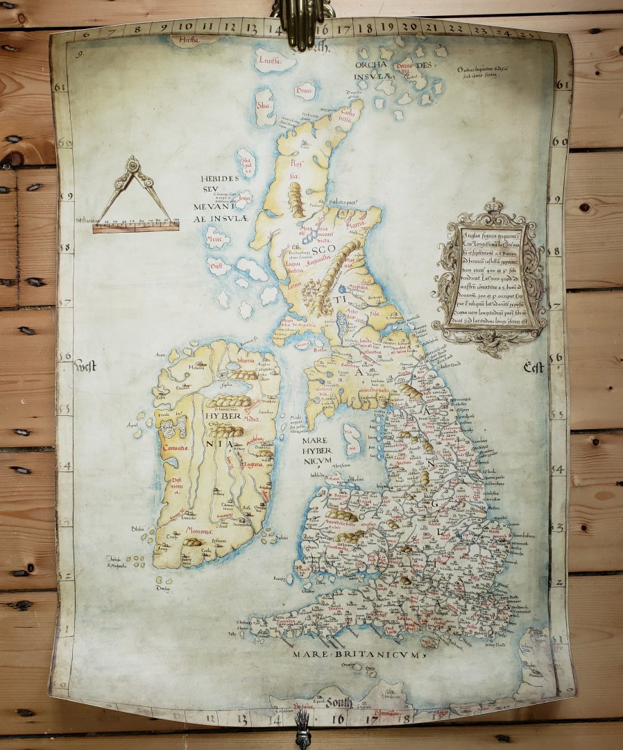
Facsimile map “Angliae Figura” of 1537 reproduced from Cotton MS Augustus I.i.9 held in the British Library, the most important manuscript map created in the reign of Henry VIII, which hung in the wall of Hampton Court Palace during his lifetime. Commentary includes the history of mapping Britain from c.325 BC to AD 1540 as well as a detailed study of the map itself.
£150.00


King Henry's Map of the British Isles [boxed map with accompanying slipcased commentary volume].
Date of Publication: 2009
Stock Code: 11470
Free postage to any UK address, and
free postage on overseas orders over £150.
Overseas orders below £150 –
Europe £7.95 / USA £14.95 / Rest Of World £11.95
Find out more about international shipping including heavy items & customs & taxes.
All items are guaranteed to be as described & are fully insured in transit. See our returns policy & find out about the bookselling terms we use.