Browse all webshop titles

Or search for something specific
Johnston, W & A. K.
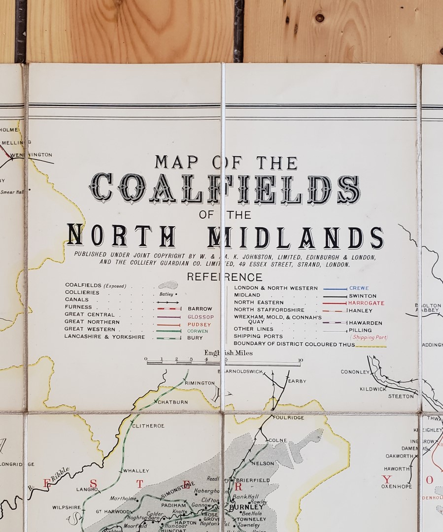
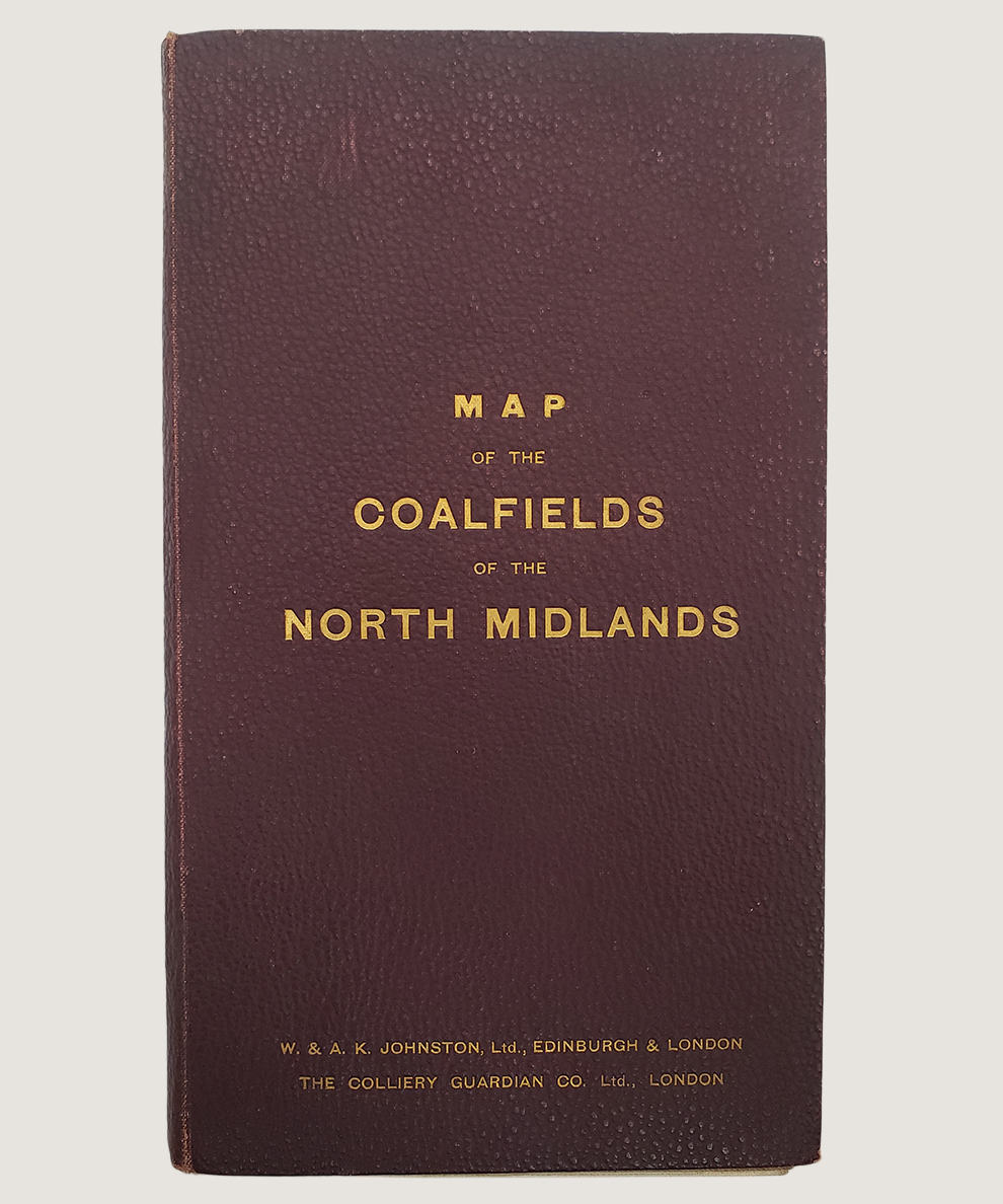
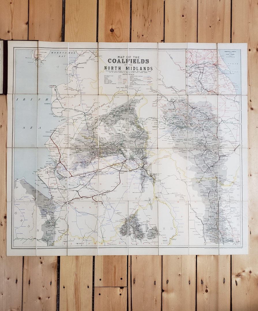
Map of the Coalfields of the North Midlands.
Publisher: W & A. K. Johnston, Edinburgh & London;
Date of Publication: 1900
Stock Code: 11621
Map dimensions 90 cm x 79.5 cm, dissected into 32 sections, mounted onto linen and folded into maroon pebbled cloth case with gilt titles to upper board. With publishers’ ads to front paste-down and verso of upper section of map. Railway lines, ports, sea and boundaries marked in colour, alongside the collieries and coalfields. From Lancaster in the north, to Barlaston in the south; and Nottingham in the east to Denbigh in the west. With ‘Shipping Ports of the East Coast’ map insert to upper right corner. The map unfolded is bright, clean and crisp and the maroon pebbled cloth case is in similar condition.
£125.00


Map of the Coalfields of the North Midlands.
Date of Publication: 1900
Stock Code: 11621
Free postage to any UK address, and
free postage on overseas orders over £150.
Overseas orders below £150 –
Europe £7.95 / USA £14.95 / Rest Of World £11.95
Find out more about international shipping including heavy items & customs & taxes.
All items are guaranteed to be as described & are fully insured in transit. See our returns policy & find out about the bookselling terms we use.