Browse all webshop titles

Or search for something specific
Betts, John.
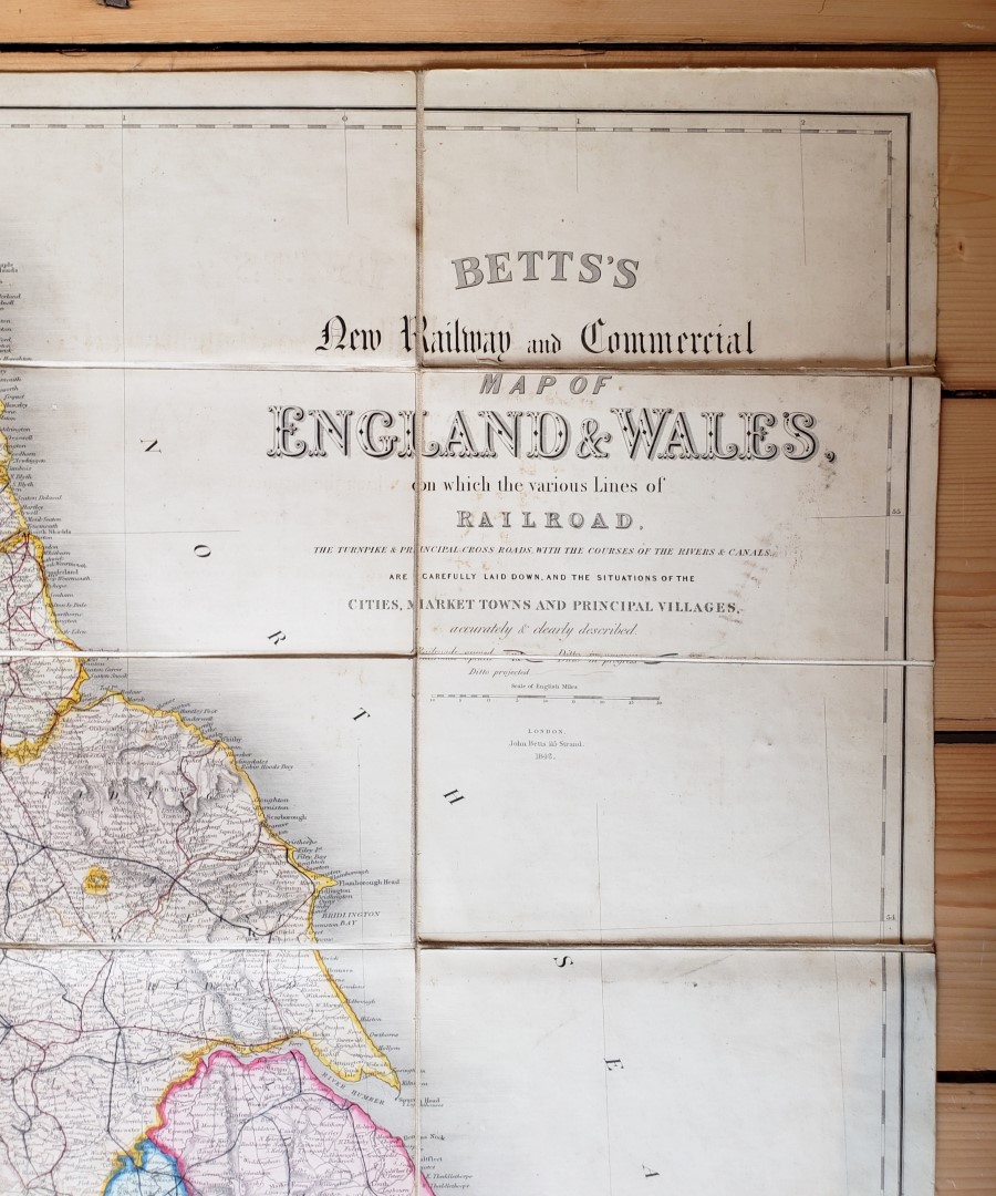
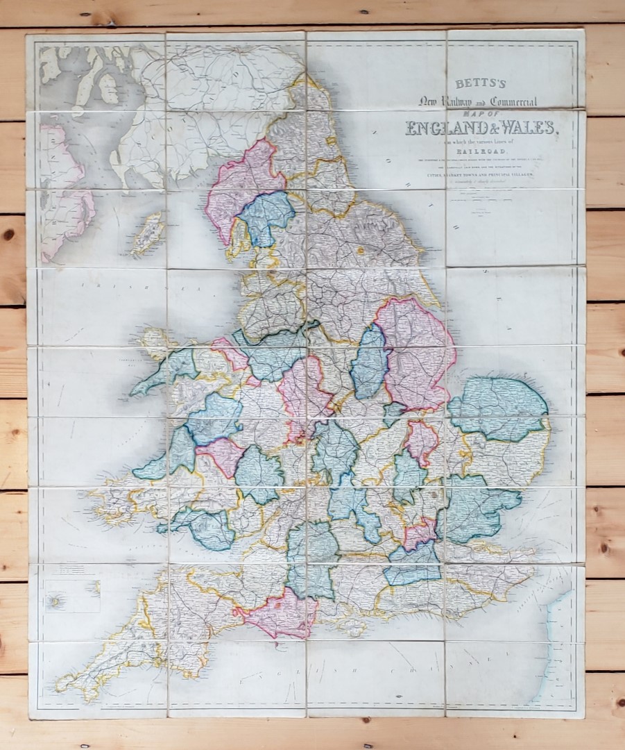
Betts' New Railway and Commercial Map of England & Wales on which the Various Lines of Railroad, the Turnpike & Principal Cross Roads with the Courses of the Rivers & Canals are Carefully Laid Down, and the Situations of the Cities, Market Towns and Principal Villages accurately and clearly described.
Publisher: John Betts, London;
Date of Publication: 1846
Stock Code: 12133
Large map 95 cm x 77 cm, hand-coloured, divided into 36 sections, mounted on cloth and folded into green boards to fit matching cloth covered case. Printed paper onlay to map and gilt titles to green paper-covered thin card case. Map boards lightly soiled, with very slight loss to onlay corners; a few small stains to reverse but map itself bright. Case surface soiled and lightly rubbed. A very good map in like case.
An attractive detailed map with counties and routes in colour, and many other features marked. Betts is perhaps best known as a publisher of cartographic guides and educational puzzles, as well as folding globes.
£120.00


Betts' New Railway and Commercial Map of England & Wales on which the Various Lines of Railroad, the Turnpike & Principal Cross Roads with the Courses of the Rivers & Canals are Carefully Laid Down, and the Situations of the Cities, Market Towns and Principal Villages accurately and clearly described.
Date of Publication: 1846
Stock Code: 12133
Free postage to any UK address, and
free postage on overseas orders over £150.
Overseas orders below £150 –
Europe £7.95 / USA £14.95 / Rest Of World £11.95
Find out more about international shipping including heavy items & customs & taxes.
All items are guaranteed to be as described & are fully insured in transit. See our returns policy & find out about the bookselling terms we use.