Browse all webshop titles

Or search for something specific
Bartholomew, John.
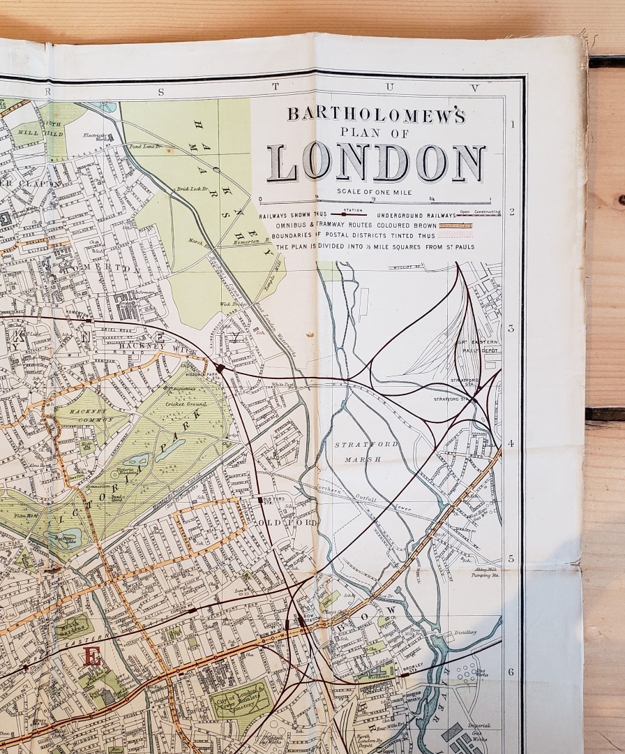
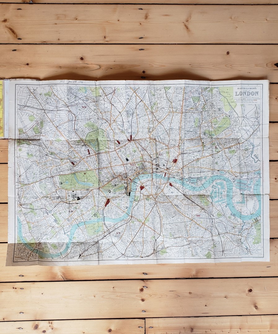
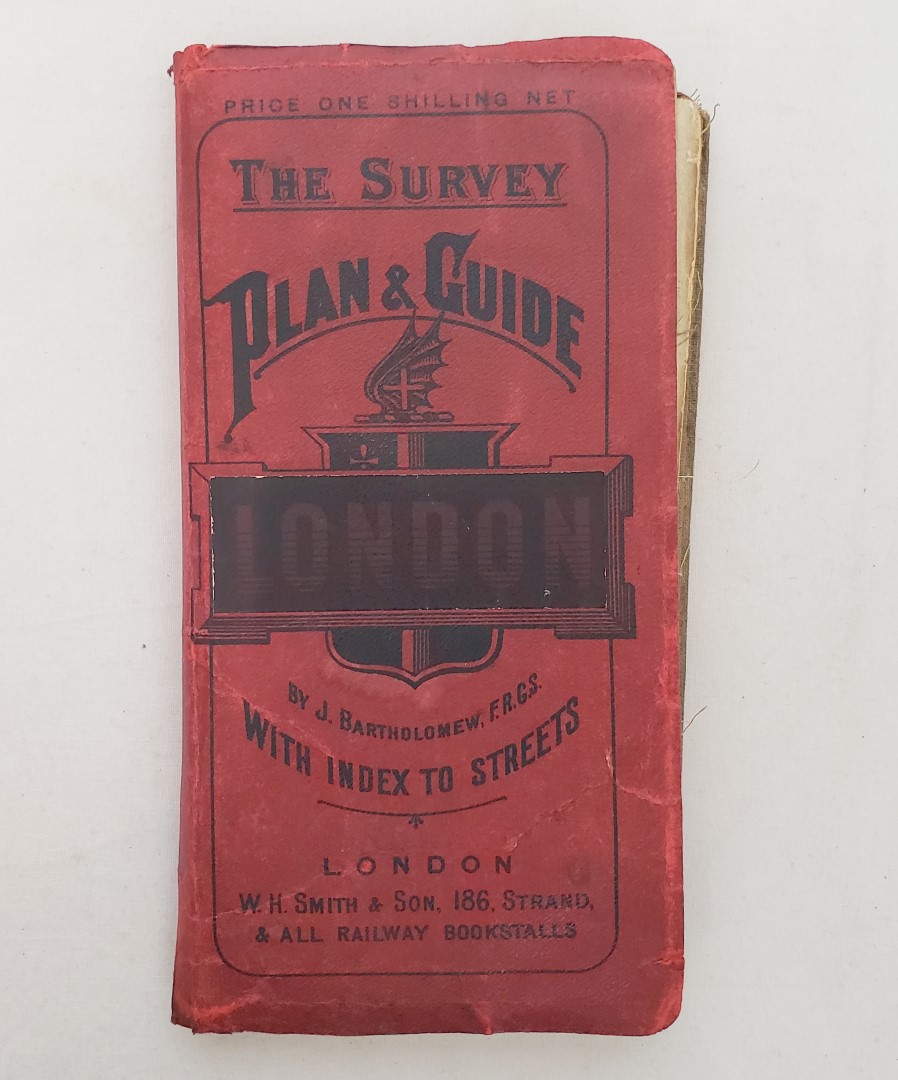
The Survey Plan & Guide to London: With Index to Streets.
Publisher: John Bartholomew & Co., Edinburgh;
Date of Publication: 1910
Stock Code: 12212
Map 84cm x 59.5cm single sheet printed on paper, mounted on linen and folded into 36 sections, in printed maroon card wraps with pp. 44 “Visitor’s Guide to London” and street index. Printed in colour, with rail, tram and omnibus routes marked, and postal districts. Bartholomew maps advertisements to lower panel of wraps. Map clean and bright. A very good copy. Covers a little creased and soiled, with repair to upper wrap and wear to spine tips. Ownership initials in ink with date 1914 above Visitor’s Guide title, and to top margin of map. A few small nicks to edge at folds, mainly to margins; linen a touch frayed and soiled.
Covers from Hampstead Heath in the north to Nunhead Cemetery in the south, from Shepherd’s Bush station in the west to East India Dock in the east. Bartholomew’s produced these maps from the 1870s until well into the twentieth century. An attractive map of London from just before the Great War.
£45.00


The Survey Plan & Guide to London: With Index to Streets.
Date of Publication: 1910
Stock Code: 12212
Free postage to any UK address, and
free postage on overseas orders over £150.
Overseas orders below £150 –
Europe £7.95 / USA £14.95 / Rest Of World £11.95
Find out more about international shipping including heavy items & customs & taxes.
All items are guaranteed to be as described & are fully insured in transit. See our returns policy & find out about the bookselling terms we use.