Browse all webshop titles

Or search for something specific
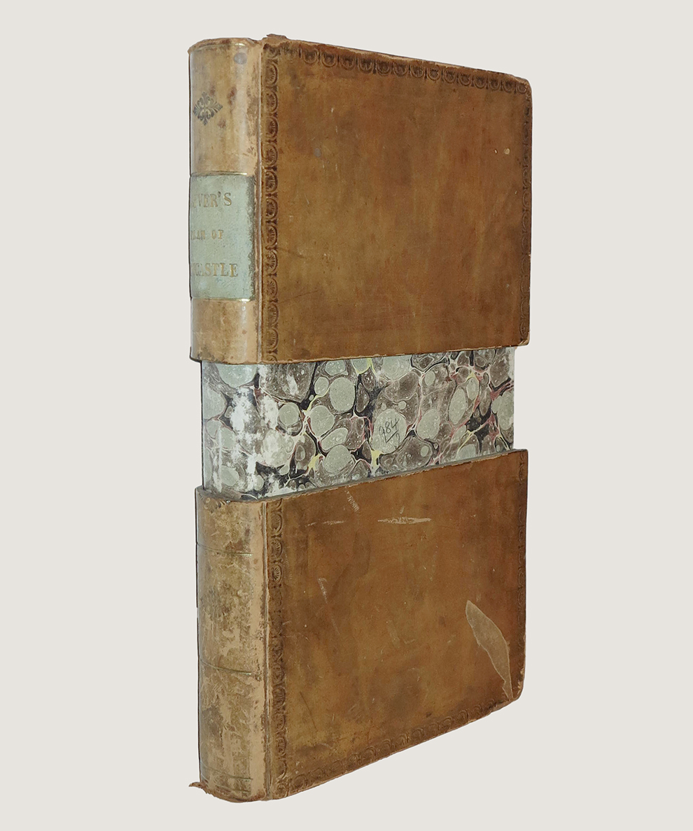
Oliver, Thomas.
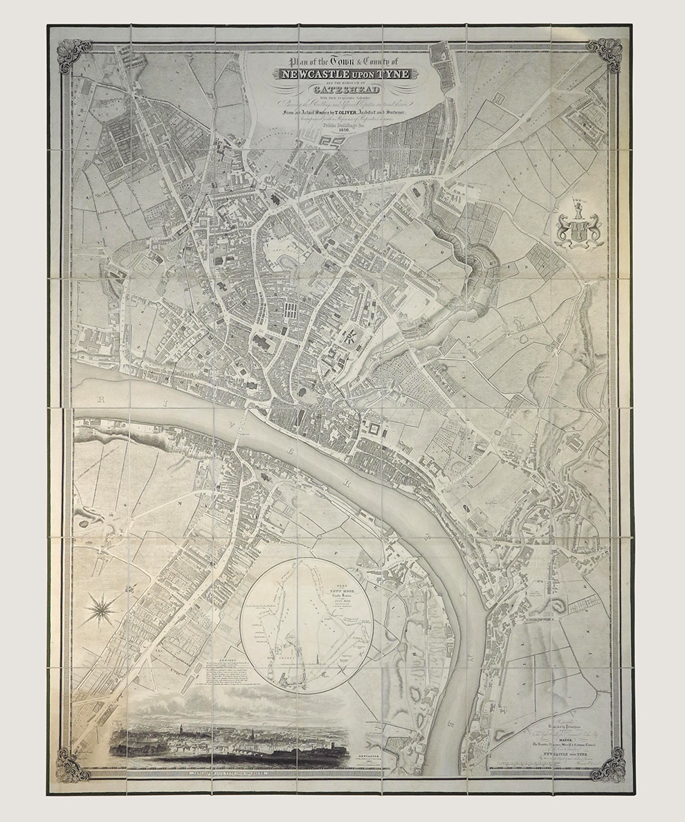
Plan of the Town & County of Newcastle upon Tyne and the Borough of Gateshead with their respective suburbs. [“The Finest Engraved Map of Newcastle Ever Printed”].
Publisher: Thomas Oliver, Newcastle upon Tyne;
Date of Publication: 1831
Stock Code: 14477
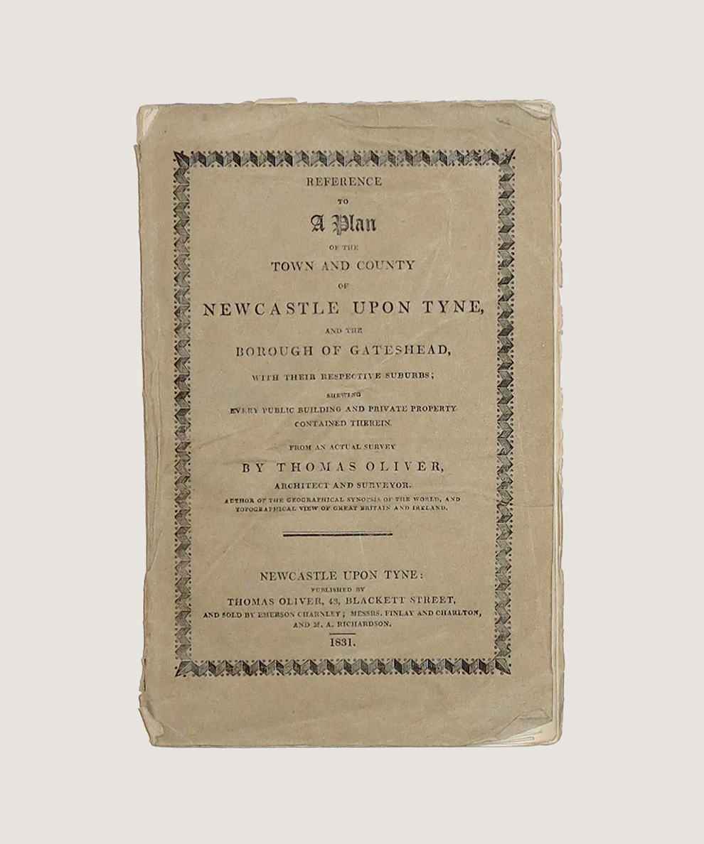
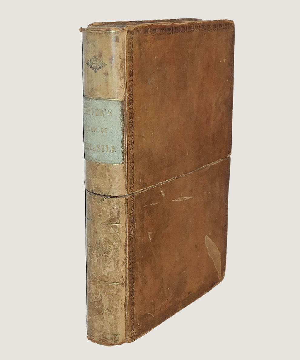
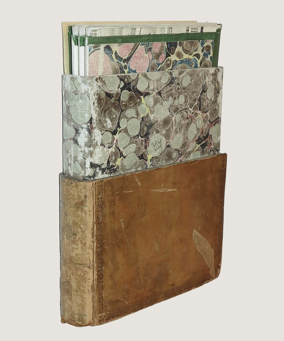
Portrait map approximately 52” x 40”, engraved by W. Lizars of Edinburgh, dissected and laid onto linen, edged in green. Scale: 3 chains to an inch. Housed in a brown calf book-style slipscase, titled in gilt to green leather spine label, blind rolls to boards, all edges marbled. The area covered is from St Peter’s and Byker Toll in the East to Westgate Hill Cemetery in the West, Arthur’s Hill and the Town Moor to the North and James’ Hospital to the South to include the majority of Gateshead. It is embellished with a cartouche with titles, engravings of the Town & County Arms to the top right corner and a view of Newcastle from the South to lower edge, taken from Oliver’s drawing “on the spot”. With the scarce key: duodecimo pamphlet in original buff paper wrappers, titled to upper cover, pp., 52. When combined, the map and key allow the reader to identify the corporate and personal residents of buildings across the city. Shelf-wear to extremities of case, spine rubbed, scuff to upper board with slight loss. The slightest of toning to small areas of map, and green edges a little worn, but generally clean, bright, and fresh. Creases to wraps of key, with slight loss to head of spine, contents clean and bright. Overall a remarkably well-preserved copy. Near-fine in very good slipcase.
Thomas Oliver (1791-1857) was a prominent surveyor and architect in the classical tradition, whose best known work today is the handsome Leazes Terrace in Newcastle upon Tyne. He produced a series of local maps and plans from the 1830s and was employed by the Liverpool and Manchester Railway Company as surveyor (ODNB). Arguably Newcastle’s finest surveyor, he once turned down a knighthood. "The finest map of Newcastle was published in 1831 by T Oliver... from an actual survey made the year previous, it was a superb map never since surpassed... It is on the largest scale, and is the most accurate and carefully got up map of the town up to this time” (F. Graham, Maps of Newcastle). The 1830s was a time of dramatic flux for the city, as one observer remarked ‘you walk into what has long been termed the coal hole of the north and find yourself in a city of palaces, a fairyland of newness, brightness, and modern elegance’ the extent and social makeup of those palaces is captured here in the key, which provides an extensive guide to the addresses of residents of the city. This is the first plan to show a completed Eldon Square, the new developments at Percy Street, Westgate Hill, and Sandyford. Surveyed with great accuracy this highly detailed plan is exquisitely engraved and affords a highly detailed snapshot of a town in the throes of the industrial revolution.
£1500.00


Plan of the Town & County of Newcastle upon Tyne and the Borough of Gateshead with their respective suburbs. [“The Finest Engraved Map of Newcastle Ever Printed”].
Date of Publication: 1831
Stock Code: 14477
Free postage to any UK address, and
free postage on overseas orders over £150.
Overseas orders below £150 –
Europe £7.95 / USA £14.95 / Rest Of World £11.95
Find out more about international shipping including heavy items & customs & taxes.
All items are guaranteed to be as described & are fully insured in transit. See our returns policy & find out about the bookselling terms we use.