Browse all webshop titles

Or search for something specific
Stanford, Edward
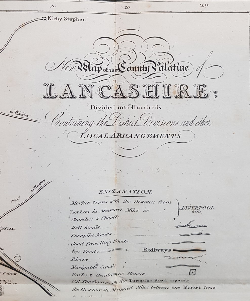
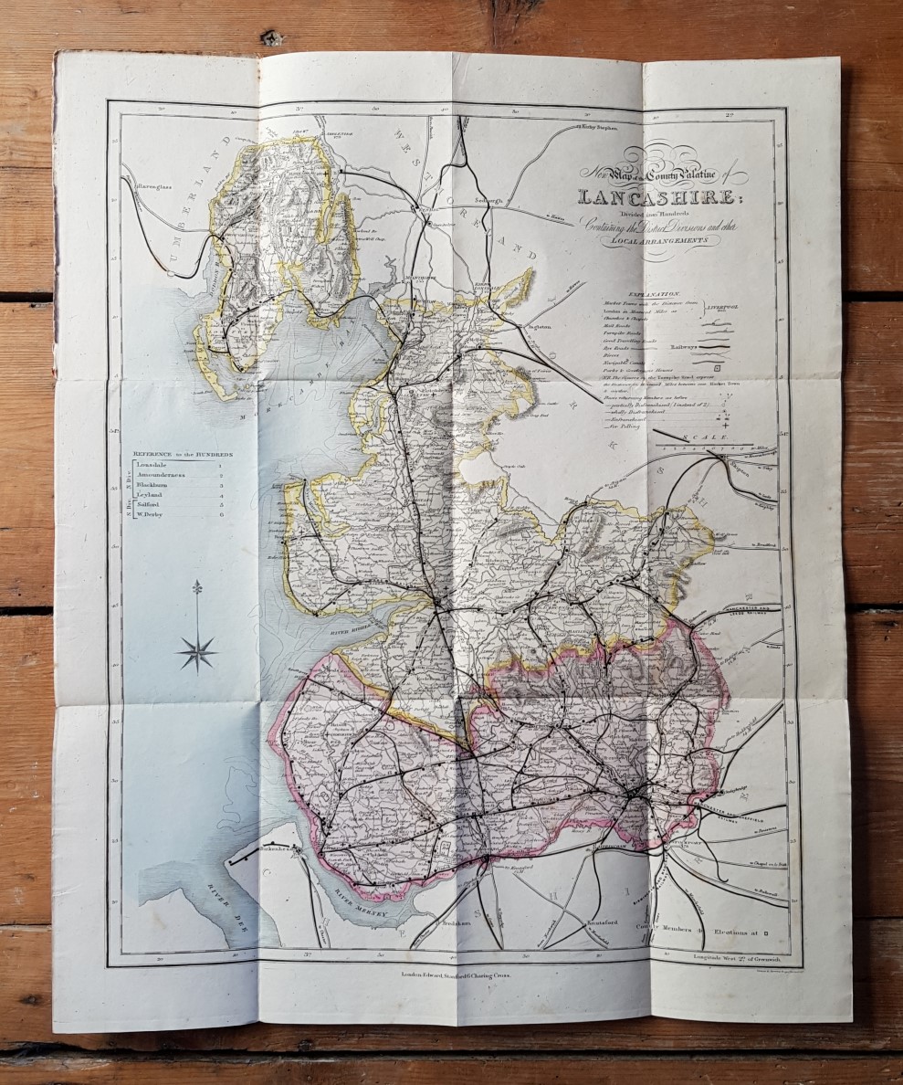
New Map of the County Palatine of Lancashire: Divided into Hundreds Containing the District Divisions and Other Local Arrangements.
Publisher: Edward Stanford, London;
Date of Publication: 1880
Stock Code: 8120
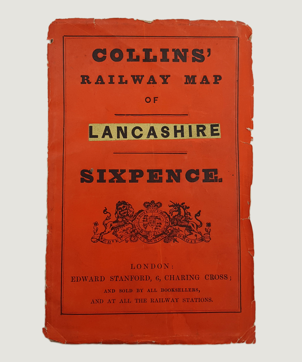
Pocket map approximately 47 cm x 39 cm, single sheet folded into 12 sections inside printed orange card covers. Cover nicked & creased to edge with substantial splits to spine. Map lightly foxed, mainly to edge. A Very Good map in Good cover.
County map with boundaries delineated in colour; railways, canals, main roads, market towns and country houses and estates marked.
£25.00


New Map of the County Palatine of Lancashire: Divided into Hundreds Containing the District Divisions and Other Local Arrangements.
Date of Publication: 1880
Stock Code: 8120
Free postage to any UK address, and
free postage on overseas orders over £150.
Overseas orders below £150 –
Europe £7.95 / USA £14.95 / Rest Of World £11.95
Find out more about international shipping including heavy items & customs & taxes.
All items are guaranteed to be as described & are fully insured in transit. See our returns policy & find out about the bookselling terms we use.