Browse all webshop titles

Or search for something specific
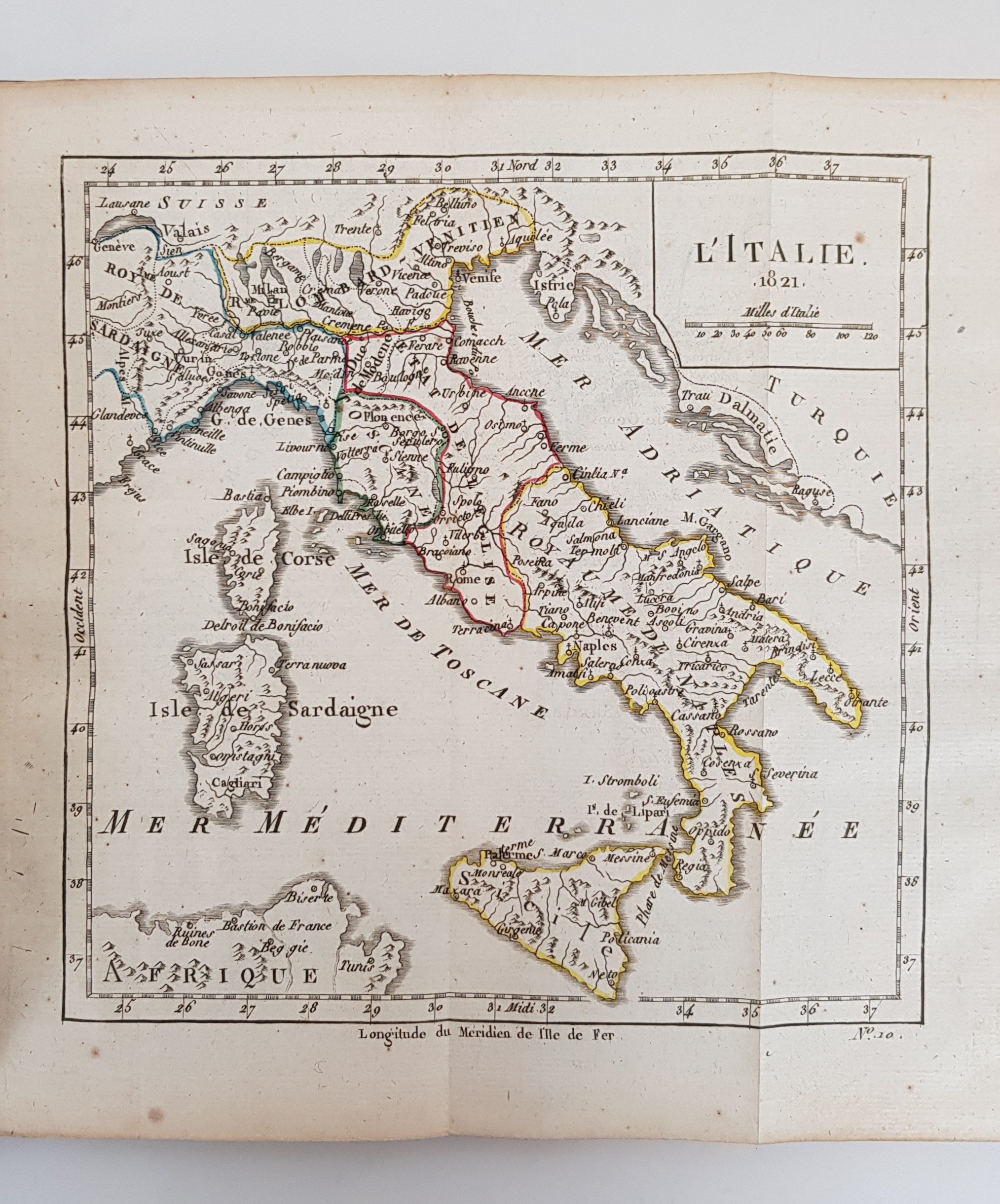
[Louis, Brion de la Tour].
Atlas et Tables Elementaires de Geographie Ancienne et Moderne, Destinees a L'Education de la Jeunesse.
Publisher: Delalain, Paris;
Date of Publication: 1821
Stock Code: 8272
Nouvelle edition. Small quarto, pp. viii, 100. 31 numbered gate-fold maps hand-coloured in outline, as called for (the Plate Index lists 31 maps, but the final map is mis-numbered as No. 32). Full polished calf, re-backed; gilt titles to maroon label to spine, and gilt decoration to compartments. Marbled endpapers. Covers lightly scuffed with wear at corners. Bookplate of Bewick scholar D.W.S. Gray to front paste-down; scattered foxing and soiling, and a few very minor ink-stains. Small tear to Map no 1 at hinge, with a little associated mis-folding. A Very Good copy.
A charming elementary atlas for use in schools with a double-hemisphere map of the world and historical maps of the Holy Land, Roman Empire etc., and a geographical vocabulary. Scarce.
£350.00


Atlas et Tables Elementaires de Geographie Ancienne et Moderne, Destinees a L'Education de la Jeunesse.
Date of Publication: 1821
Stock Code: 8272
Free postage to any UK address, and
free postage on overseas orders over £150.
Overseas orders below £150, £14.95 worldwide.
Find out more about international shipping including heavy items & customs & taxes.
All items are guaranteed to be as described & are fully insured in transit. See our returns policy & find out about the bookselling terms we use.