
Browse all webshop titles

Or search for something specific
Cruchley, G[eorge].
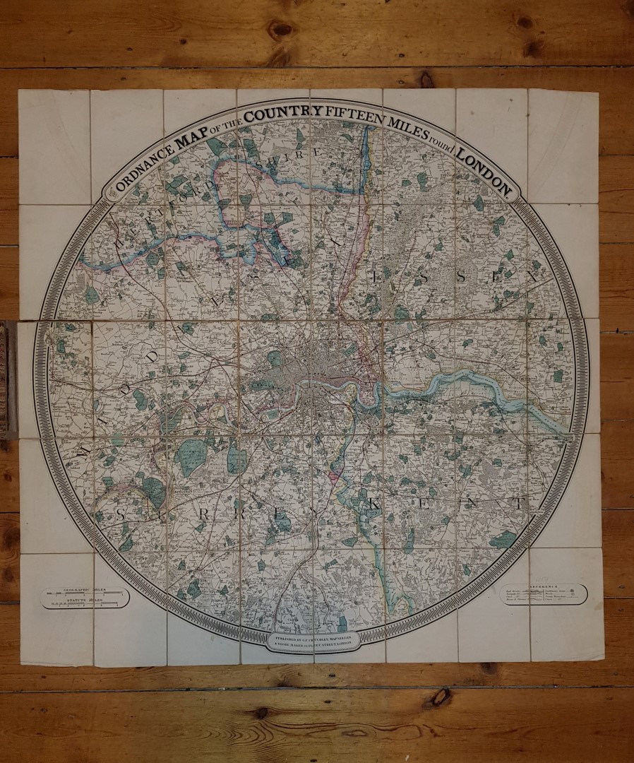
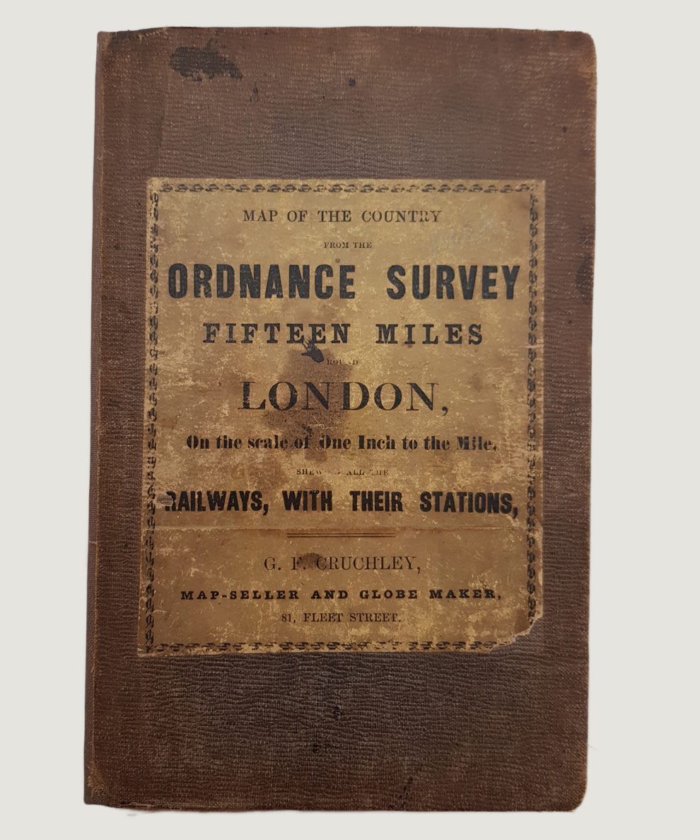
Map of the Country from the Ordnance Survey Fifteen Miles Round London, On the Scale of One Inch to the Mile, Shewing all the Railways, with their Stations.
Publisher: G. F. Cruchley, London;
Date of Publication: 1859
Stock Code: 9082
Large hand-coloured map approximately 92 cm x 91 cm, dissected into 40 sections and laid onto linen, folded into covers. Sympathetically re-backed; original brown cloth boards with printed primrose-yellow title label to upper board; marbled endpapers. Covers sunned and lightly soiled with slight wear to corners and very minor loss to title label at lower right corner. Linen lightly foxed, mainly to reverse, and split at single fold; minor creasing to lower edge of map affecting margin only. Map slightly browned with minor offsetting but quite fresh. A very good copy.
An attractive and detailed circular map from Watford to Farnham and from Epsom to Epping. The Crystal Palace is shown at Sydenham (opened 1854) with railways, turnpikes, rivers & streams, Gentlemen’s Seats, woods and boundaries all marked. Scarce.
Sold


Map of the Country from the Ordnance Survey Fifteen Miles Round London, On the Scale of One Inch to the Mile, Shewing all the Railways, with their Stations.
Date of Publication: 1859
Stock Code: 9082
Free postage to any UK address, and
free postage on overseas orders over £150.
Overseas orders below £150 –
Europe £7.95 / USA £14.95 / Rest Of World £11.95
Find out more about international shipping including heavy items & customs & taxes.
All items are guaranteed to be as described & are fully insured in transit. See our returns policy & find out about the bookselling terms we use.
See all items in: Cartography