Browse all webshop titles

Or search for something specific
Cary, [John].
HOLD Cary's Traveller's Companion of a Delineation of the Turnpike Roads of England and Wales... [with] Cary’s New Itinerary or an Accurate Delineation of the Great Roads Both Direct and Cross throughout England and Wales...
Publisher: John Cary, London;
Date of Publication: 1814
Stock Code: 9630
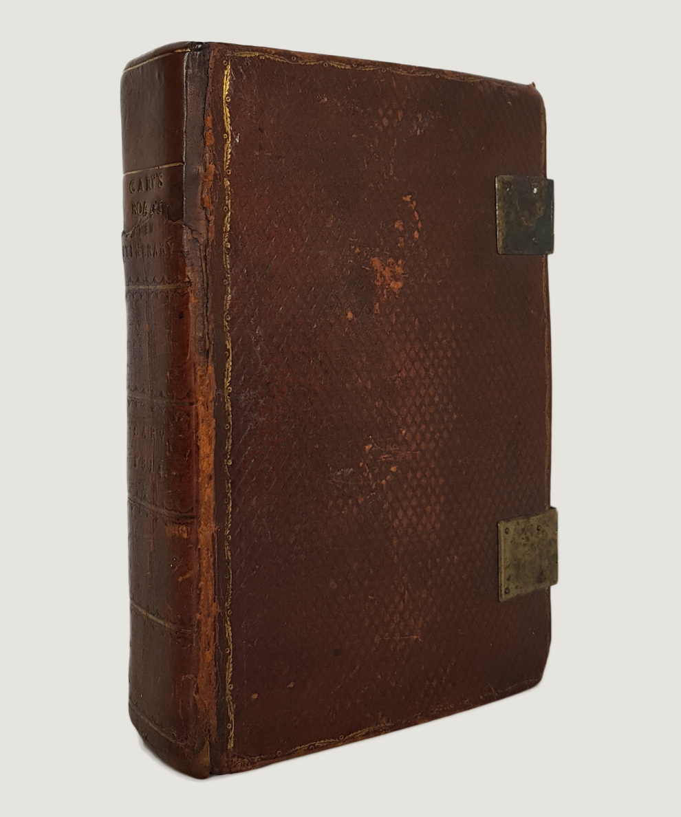
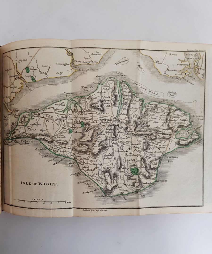
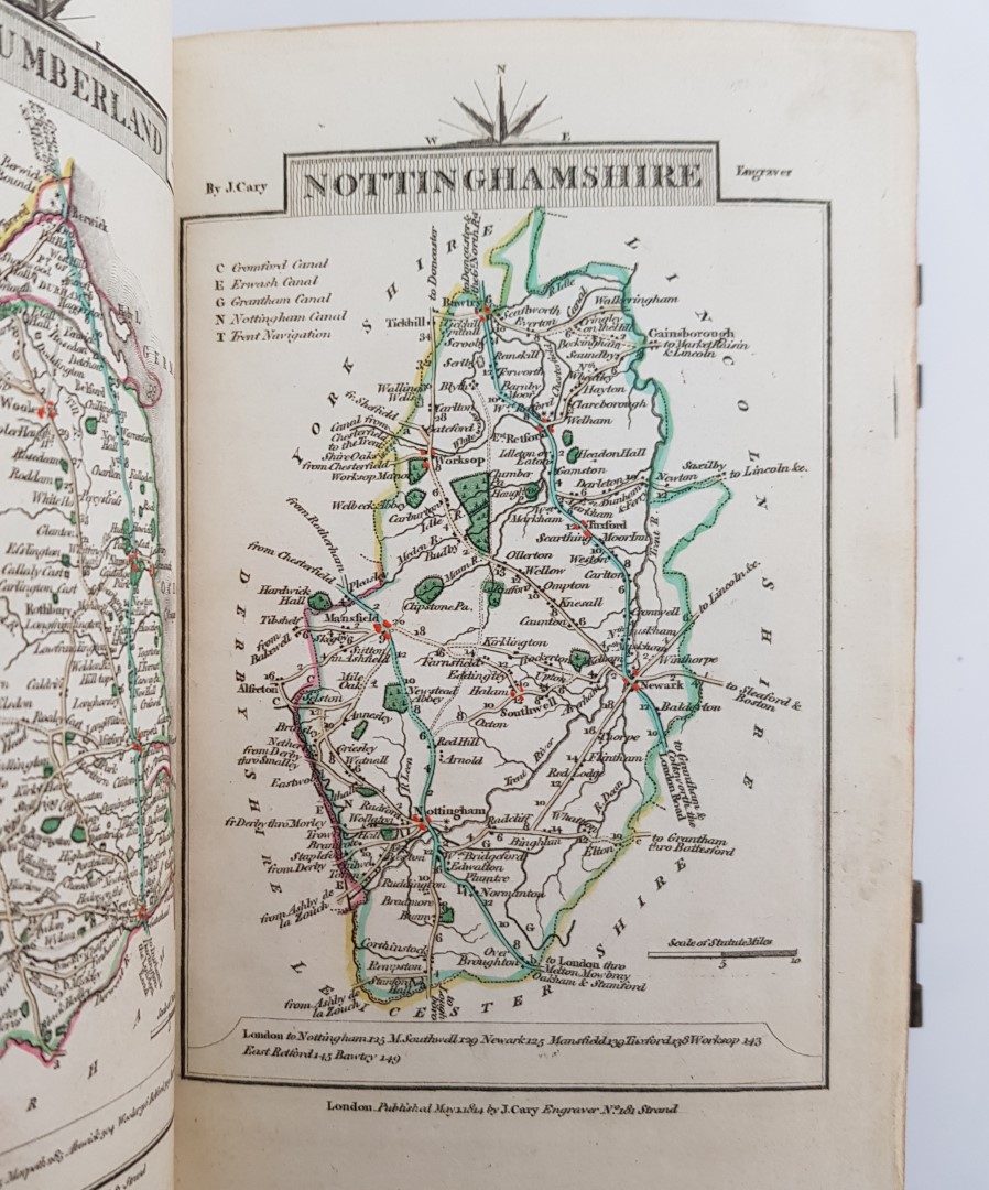
Octavo, pp. [6], including copper-engraved title-page, [16] Market Towns and Routes, [6] ads and 43 maps hand-coloured in outline (including the often-absent large folding Yorkshire map) to Traveller’s Companion; [170], including copper-engraved title and dedication page, [435], 871-941, [2] catalogue and 6 hand-coloured gate-fold maps (including map of London and environs)but bound without the large map of England. Full diced calf, sympathetically rebacked using original boards with twin brass clasps, and with original spine laid on. Wear to boards at corners. Endpapers toned from binding; loss to corner of first 2 blanks (approx 8cm x 8 cm); a little scattered foxing and offsetting; Yorkshire map very slightly mis-folded. A Very Good copy.
A portable and (just about) pocketable, copy of two of the principal works of John Cary bound as one. John Cary (circa 1754-1835), the foremost cartographer of roads in England and Wales of his time, was commissioned by the Postmaster General in 1794 to survey the country’s roads as his New Itinerary was then the standard work on the subject. This volume is of a suitable size to accompany the traveller on their journeys, and the strip design of the routes of the New Itinerary included all the directions and distances set out along the way, while the maps of the Traveller’s Companion show in detail each of the English counties and Welsh regions with their major routes and landmarks. Routes from London to all parts of England and Wales are included in every direction with information on towns, cities, markets, mail arrivals and departures, canals and rivers en route, population statistics, details of inns supplying transport and of packet boats each with times of departure, and even details of the country seats of gentry and nobility near the roads. Cary’s revolutionary approach made journeys around Britain much easier for the traveller with such comprehensive information readily to hand, and set a high standard for many later works with the same intent. An attractive copy that sits well in the hand.
£650.00


HOLD Cary's Traveller's Companion of a Delineation of the Turnpike Roads of England and Wales... [with] Cary’s New Itinerary or an Accurate Delineation of the Great Roads Both Direct and Cross throughout England and Wales...
Date of Publication: 1814
Stock Code: 9630
Free postage to any UK address, and
free postage on overseas orders over £150.
Overseas orders below £150 –
Europe £6 / USA £14 / Rest Of World £9
Find out more about international shipping including heavy items & customs & taxes.
All items are guaranteed to be as described & are fully insured in transit. See our returns policy & find out about the bookselling terms we use.