Browse all webshop titles

Or search for something specific
Oliver, Thomas.
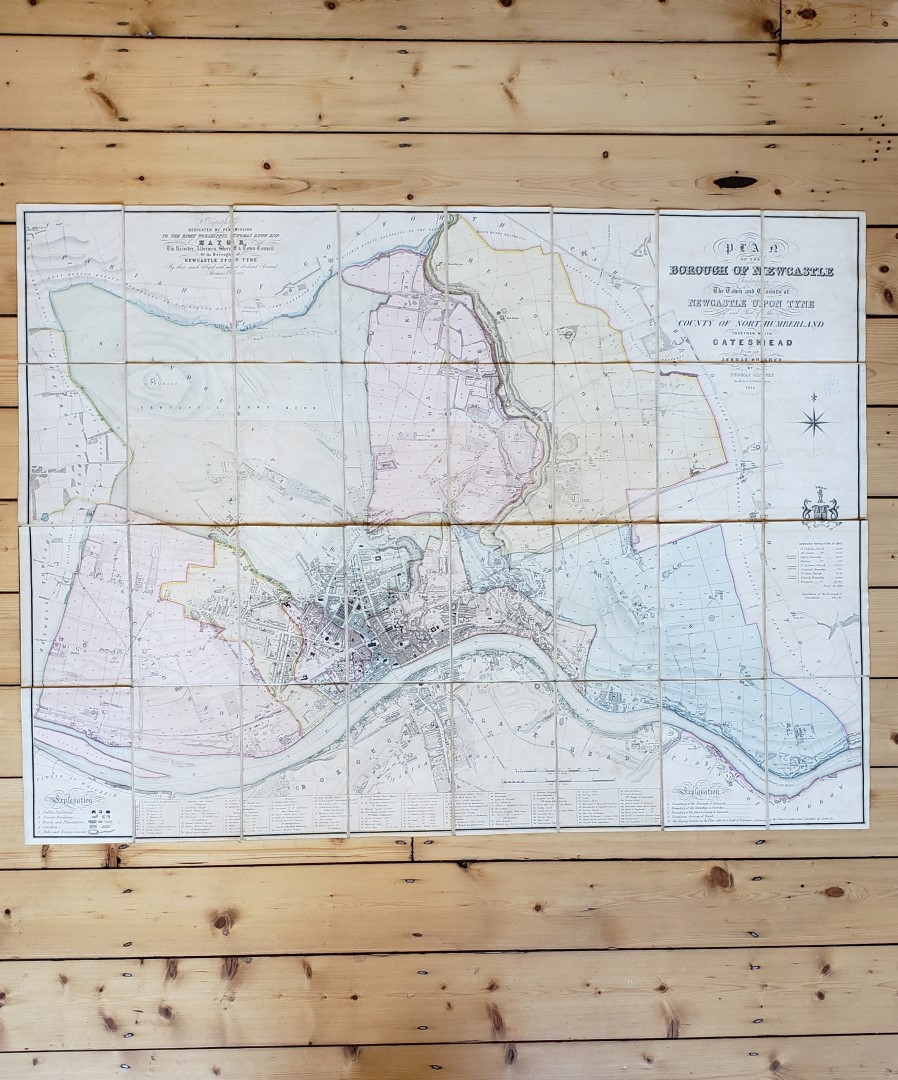
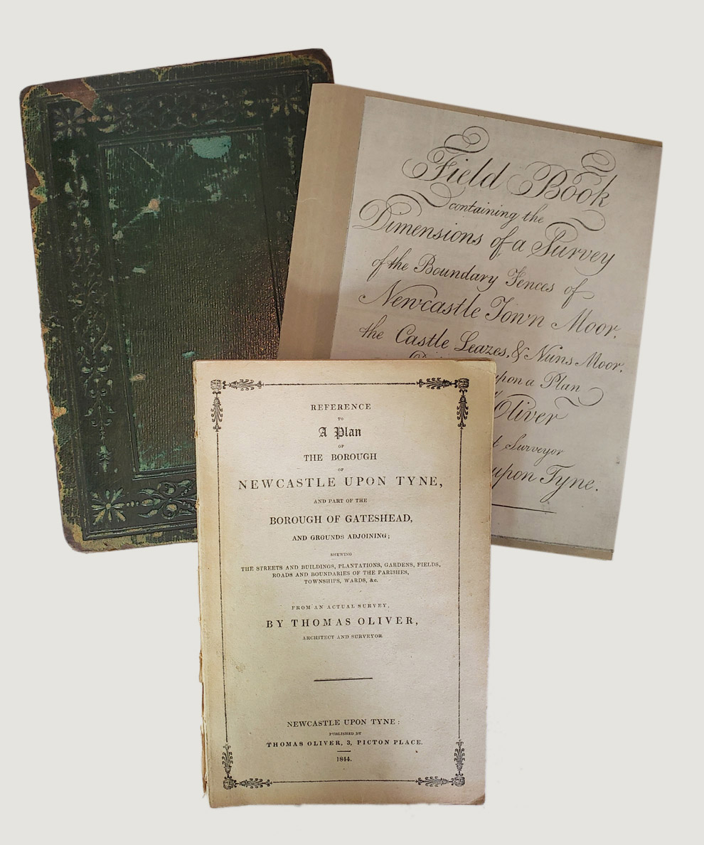
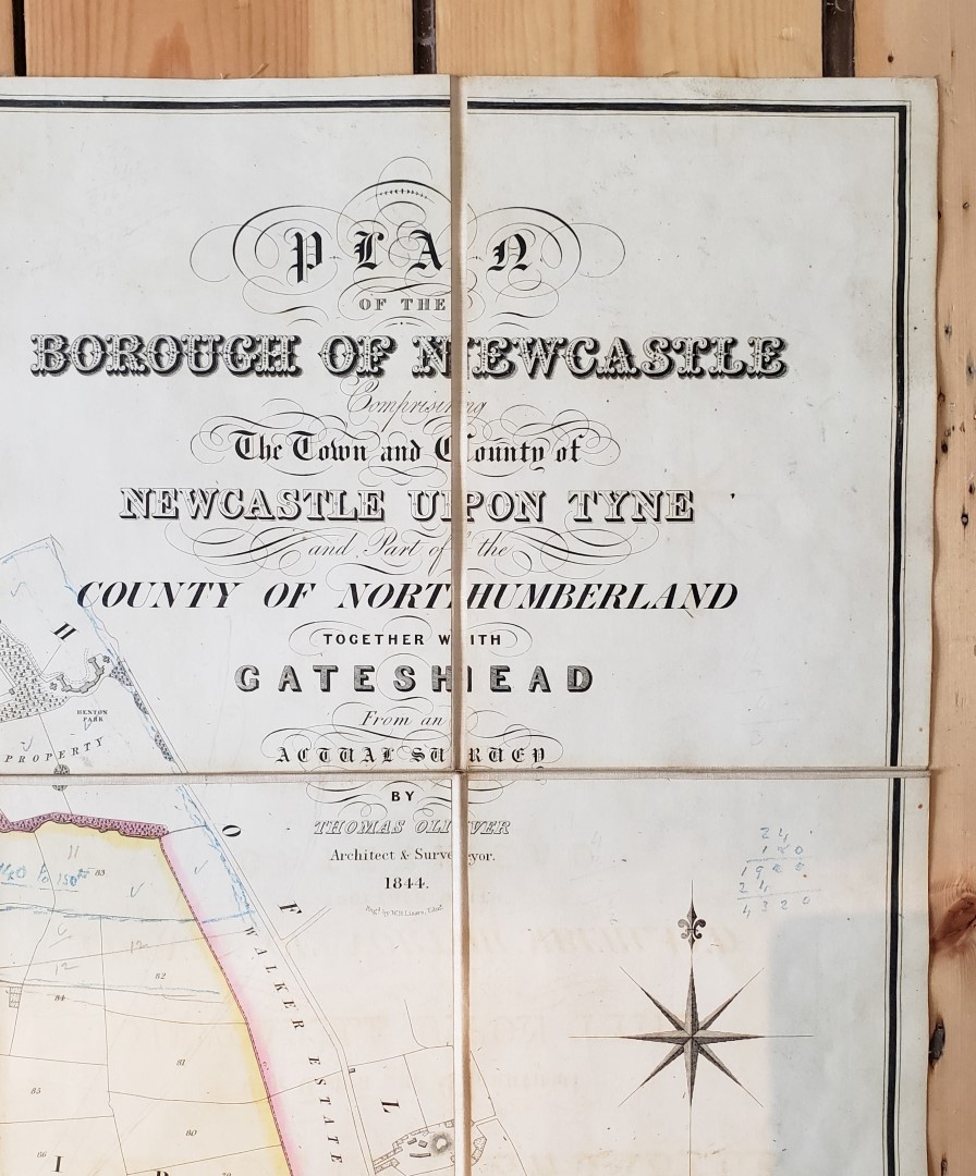
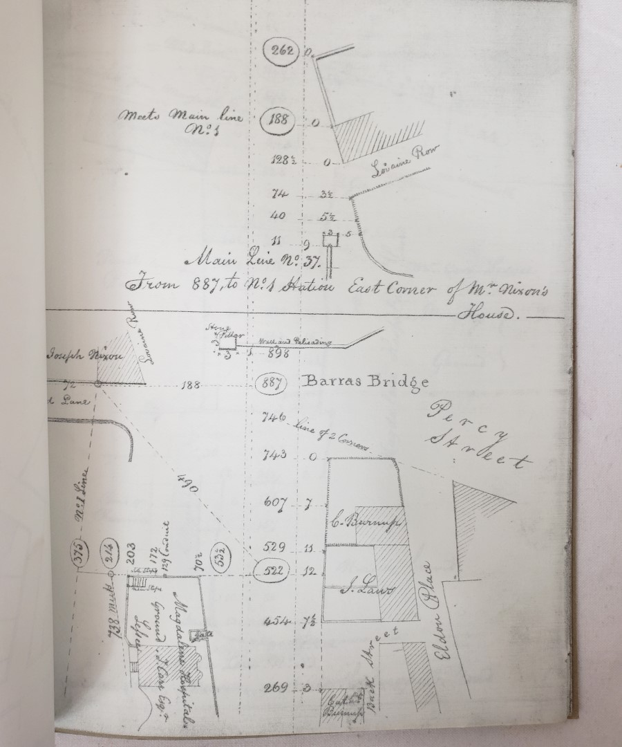
Plan of the Borough of Newcastle comprising the Town and County of Newcastle upon Tyne and Part of the County of Northumberland Together with Gateshead from an Actual Survey by Thomas Oliver, 1844 [with] Reference to a Plan of the Borough of Newcastle upon Tyne and Part of the Borough of Gateshead and Grounds Adjoining.
Publisher: Thomas Oliver, Newcastle upon Tyne;
Date of Publication: 1844
Stock Code: 11939
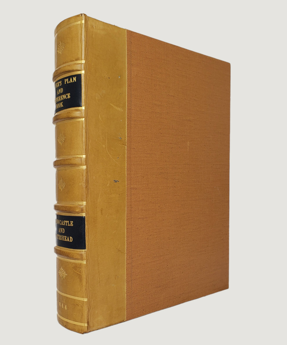
Large, hand-coloured, landscape map approx. 119 cm x 89 cm, engraved by W. H. Lizars of Edinburgh, dissected into 32 parts, laid onto linen, and folded into green leather boards decorated in blind. The area covered extends from Walker estate in the east to Benwell and Fenham in the west, and from Kenton and Gosforth on the north side to Dunston and the Sunderland Turnpike on the south, covering an area of over 8,000 acres. Scale : 10 inches to a mile. Each township is dilineated with hand-colouring. The “Reference” volume: octavo, pp. viii, 104, in the publisher’s original cream printed thin card wraps. Map and “Reference” housed together in felt-lined bespoke half-calf clam-shell box, with 5 raised bands and gilt titles to black labels to spine and brown buckram-covered boards. Map upper board surface scuffed, and lower board lacking. Small calculation in blue pencil to map below titles, and further calculations to verso, Map lightly soiled with slight foxing to linen. “Reference” lightly surface soiled with loss to spine, and a little scattered light foxing; needs re-stitching.
The “Reference” volume contains detailed historical and descriptive remarks on the principal estates and buildings of interest on the map with ownership and acreage of every field, garden and plantation, and all boundaries distinctly marked. Thomas Oliver (1791-1857) was a prominent surveyor and architect in the classical tradition, whose best known work today is the handsome Leazes Terrace in Newcastle upon Tyne. He produced a series of superb local maps and plans from the 1830s and was employed by the Liverpool and Manchester Railway Company as surveyor (Oxford DNB). "The finest map of Newcastle was printed in 1831 by T Oliver...from an actual survey made the year previous... it was a superb map...Oliver's last map was published in 1844... it showed all the new streets built since his first as well as the railways and stations". (F. Graham, Maps of Newcastle). An attractive and rare map, particularly so with the all-important Reference volume.
£1250.00


Plan of the Borough of Newcastle comprising the Town and County of Newcastle upon Tyne and Part of the County of Northumberland Together with Gateshead from an Actual Survey by Thomas Oliver, 1844 [with] Reference to a Plan of the Borough of Newcastle upon Tyne and Part of the Borough of Gateshead and Grounds Adjoining.
Date of Publication: 1844
Stock Code: 11939
Free postage to any UK address, and
free postage on overseas orders over £150.
Overseas orders below £150 –
Europe £7.95 / USA £14.95 / Rest Of World £11.95
Find out more about international shipping including heavy items & customs & taxes.
All items are guaranteed to be as described & are fully insured in transit. See our returns policy & find out about the bookselling terms we use.