Browse all webshop titles

Or search for something specific
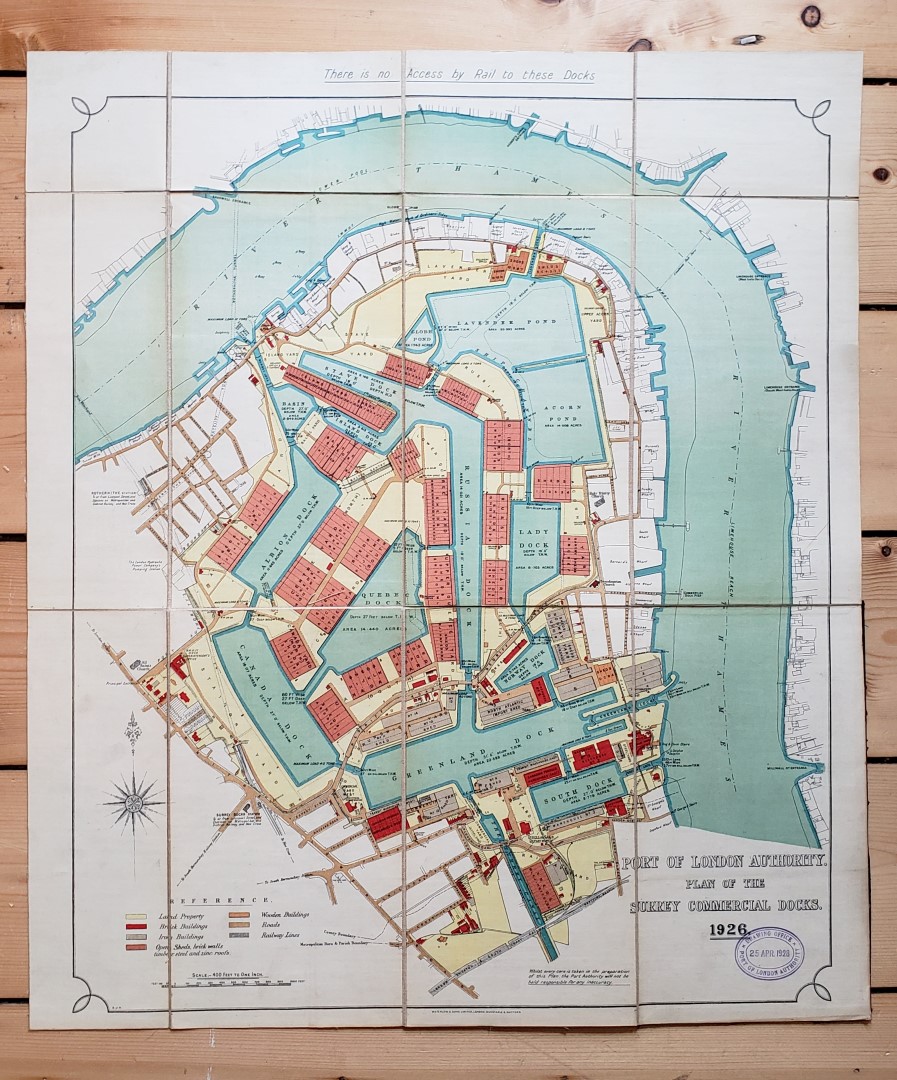
Port of London Authority.
Plan of the Surrey Commercial Docks 1926.
Publisher: Port of London Authority, London;
Date of Publication: 1926
Stock Code: 11953
Colour lithographed plan approximately 46.5 cm x 56 cm, Scale 400 feet to 1 inch, dissected into 12 sections, backed onto linen and folded into dark maroon cloth-covered boards with printed paper title onlay. Boards a little worn to edges; Port of London Authority Drawing Office stamp to lower right-hand corner dated 1928 otherwise a clean and vivid example. Map Near Fine in very good boards.
Vividly coloured plan of the redeveloped Surrey Commercial Docks district in Rotherhithe in East London, now renamed Surrey Quays. Most of the original buildings have been demolished as part of the redevelopment of the entire Docklands area, which is now repurposed for for residential use, with the largest marina in Greater London and plentiful nature reserves.
£350.00


Plan of the Surrey Commercial Docks 1926.
Date of Publication: 1926
Stock Code: 11953
Free postage to any UK address, and
free postage on overseas orders over £150.
Overseas orders below £150 –
Europe £7.95 / USA £14.95 / Rest Of World £11.95
Find out more about international shipping including heavy items & customs & taxes.
All items are guaranteed to be as described & are fully insured in transit. See our returns policy & find out about the bookselling terms we use.