Browse all webshop titles

Or search for something specific
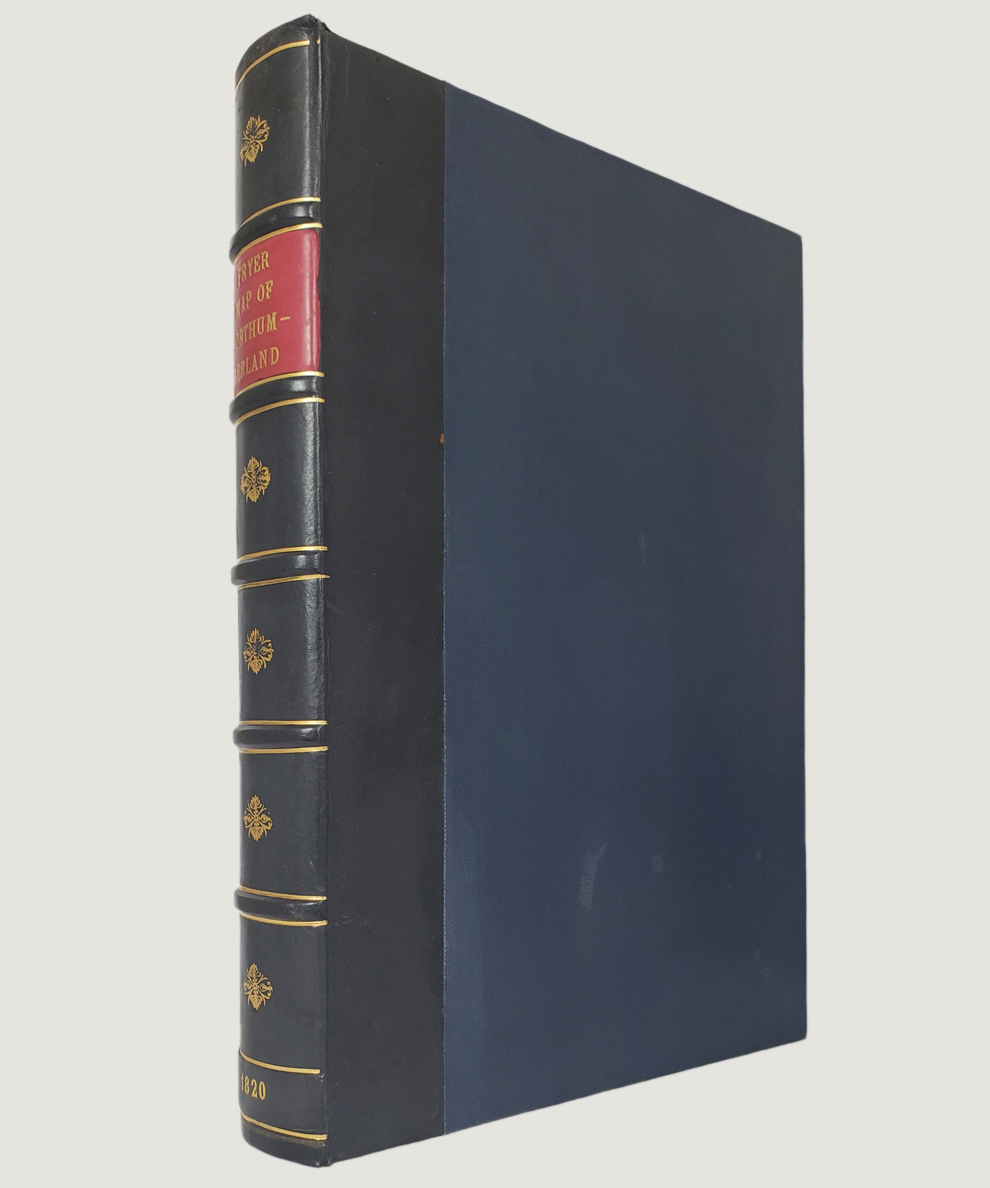
Fryer, John.
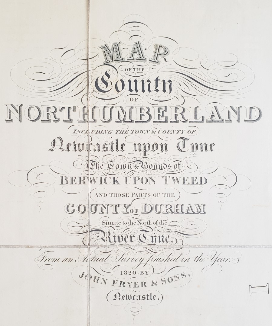
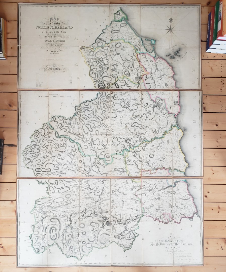
Map of the County of Northumberland including the Town and County of Newcastle upon Tyne, The Town and Bounds of Berwick upon Tweed and Those Parts of the County of Durham Situate to the North of the River Tyne from an Actual Survey Finished in 1820 [with] An Alphabetical Index to John Fryer and Sons’ Map of the County of Northumberland...
Publisher: John Fryer and Sons, Newcastle;
Date of Publication: 1820
Stock Code: 11988
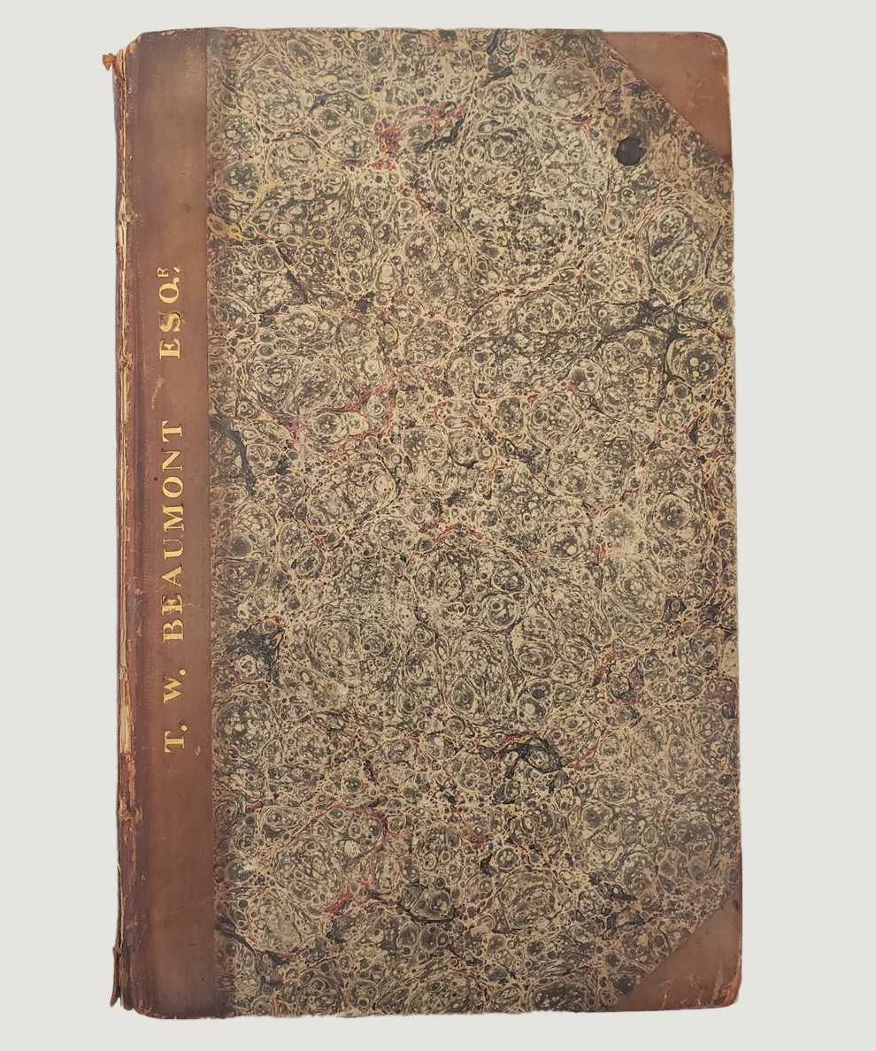
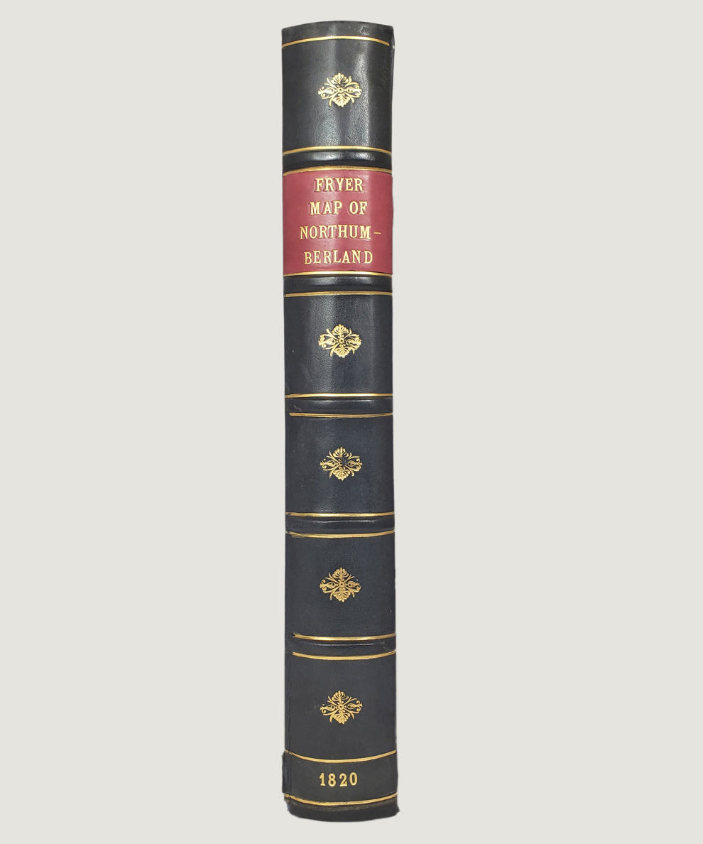
First Edition. Map engraved by M. Lambert of Newcastle, approximately 189 cm x 78 cm, dissected into 36 sections and mounted onto linen in three separate sheets, each sheet comprising 12 sections and measuring approximately 78 cm x 63 cm; scale of 8 miles to 7 and 13 16ths (roughly an inch to a mile). The map shows market towns, parishes, villages, churches, castles, houses, turnpike and other roads and parks & pleasure grounds, with ward, county and town boundaries marked and county boundaries delineated in colour; the table of “Explanation” is to lower left corner, with the dedication to Hugh, Duke of Northumberland to the bottom right. The sections are folded into later protective thin card wraps (33 cm x 22 cm). The Index, printed by Edward Walker of Pilgrim Street in Newcastle in 1822, octavo pp. 92 is bound with pp. 26 “A List of Wards, Divisions, Parishes and Constableries in the County of Northumberland” printed by J Graham of Alnwick in 1817; the two parts bound together in polished half-calf with marbled paper-covered boards. The map and Index are housed together in an attractive felt-lined clam-shell box with the appearance of a single large volume in navy blue calf spine with 5 raised bands, gilt titles to red label to spine, gilt decoration to compartments and cloth covered boards. Some very slight toning to map, otherwise in very good order without splits to linen; card wraps worn to edge. The Index volume has a cracked and very fragile upper joint, with “T. W. Beaumont Esq. in gilt to edge; contents are clean and free of annotation. Box very slightly scuffed to boards. A near fine map in like box.
This “exceedingly fine map” (Whitaker) was the very first large-scale map of the county with accurate lines of longitude and has been described as Fryer’s ‘greatest achievement’. Hugh Percy, 3rd Duke of Northumberland, appears in the Index at the head of the List of Subscribers for 5 copies, and his sponsorship ensured the dedication of the map and the details of the area surrounding his seat at Alnwick Castle. Fryer was responsible for accurate plans of local estates and large Plans of Newcastle (1770) and of the River Tyne depicting the mouth of the river (1787), and these were also made from surveys undertaken in person with local knowledge.
£1250.00


Map of the County of Northumberland including the Town and County of Newcastle upon Tyne, The Town and Bounds of Berwick upon Tweed and Those Parts of the County of Durham Situate to the North of the River Tyne from an Actual Survey Finished in 1820 [with] An Alphabetical Index to John Fryer and Sons’ Map of the County of Northumberland...
Date of Publication: 1820
Stock Code: 11988
Free postage to any UK address, and
free postage on overseas orders over £150.
Overseas orders below £150 –
Europe £7.95 / USA £14.95 / Rest Of World £11.95
Find out more about international shipping including heavy items & customs & taxes.
All items are guaranteed to be as described & are fully insured in transit. See our returns policy & find out about the bookselling terms we use.